 vesseltracker.com
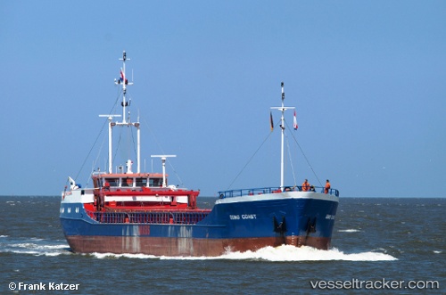
Vessel CM COAST IMO: 8418019, MMSI: 636021860 General Cargo Ship
Live AIS position:
UTC. Open sea, approx. 408 nm off the nearest listed port),
updated 2026-01-01 14:44:54 UTC.
Find the position of the vessel CM COAST on the map. The latter are known coordinates and path.
marine traffic ship tracker show on live map
The current position of vessel CM COAST is -61.85521 lat / 151.12544 lng. Updated: 2026-01-01 14:44:54 UTCCurrently sailing under the flag of Liberia
CM COAST built in 1985 year
Deadweight:
1490 tDetails:
Last coordinates of the vessel:
2026-01-01 14:44:54 UTC, -61.85521, 151.12544, course: 225, speed: 4.8